
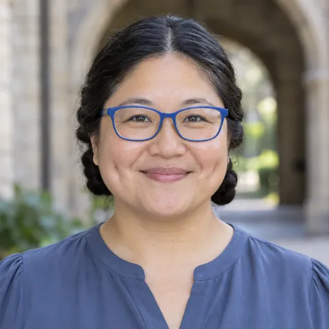
Dr. Keiko Tanaka
Assistant Teaching Professor of Environmental Science
Instructor for ENVS 250, Fall 2026
- Office
- Meridian Science Center 416
- ktanaka
@university.alkimi.ai
ENVS 250 · Environmental Science
Spatial data models, coordinate systems, map projections, remote sensing imagery, geoprocessing, and spatial analysis for environmental and infrastructure planning, using ArcGIS Pro and QGIS.
Fall 2026 · At a glance
200-level courses: intermediate, lower-division courses suitable for sophomores and above. Details: Undergraduate Catalog §9.18.
Assistant Teaching Professor of Environmental Science
Instructor for ENVS 250, Fall 2026
Questions about a major or your plan: Academic Advising Center, Lovell Hall 101, (555) 555-0158.
Class meetings
Tue & Thu, 11:00 a.m.–12:15 p.m.
Ashby Hall 230
Final exam
Wednesday, December 16, 2026
1:30–3:30 p.m., Ashby Hall 230
Office hours
Mon & Thu, 9:00–10:30 a.m.
Meridian Science Center 416
Fri, 9:00–10:00 a.m.
Virtual (Zoom link in Canvas)
You may use AI tools to troubleshoot Python geospatial scripts (ArcPy and PyQGIS), generate ideas for map design layouts, and clarify the mathematical definitions of coordinate projections. You may not submit AI-generated map layouts, use AI to automate geoprocessing assignments without personal execution in GIS software, or access AI during quizzes and the final exam.
From the syllabus
Grading
Letter grades follow the university scale (Student Handbook §4.1).
Key dates
First day of classes Past
Midterm Exam Next
Spatial Analysis Term Project
Required materials
Bolstad, Paul. GIS Fundamentals: A First Text on Geographic Information Systems. 6th ed., XanEdu Publishing, 2019.
Approx. $45 for digital access; approx. $65 for print purchase.
ArcGIS Pro student educational license and open-source QGIS desktop software suite.
Free (provided to all enrolled students).
External USB 3.0 flash drive or portable solid-state drive (minimum 32 GB) for spatial project backups.
Approx. $15 to $25.
Degree planning
What to take first, what this course opens up, and the requirements it can satisfy, from the Undergraduate Catalog.
No catalog course is required first.
Catalog wording: None.
No other catalog course lists ENVS 250 as a prerequisite.
Every course also counts toward the 120 credits needed for a bachelor's degree. Confirm your plan with your advisor or the Academic Advising Center.
No AP exam awards credit for ENVS 250 (Undergraduate Catalog §3.11).
Registration
None.
ENVS 250 is offered in the fall semester. Register through AlkimiHub self-service registration, which opens by credit standing. Until the add deadline, you don't need instructor permission as long as seats remain and you've met the prerequisites. Details: Student Handbook §3.3.
When a seat opens, AlkimiHub offers it to the first student on the waitlist and emails you. You have 24 hours to claim it before it goes to the next student. Details: Student Handbook §3.10.
Fall 2026 withdrawal deadline
Last day to withdraw with a W or elect Pass/No Pass.
Fall 2027 registration opens
By credit standing, in AlkimiHub.
The Fall 2026 add deadline passed on Sep 2, 2026.
All dates: academic calendar. Registration help: Office of the Registrar.
Official course syllabus
The syllabus as filed with the department and posted in Canvas for Fall 2026.
Term: Fall 2026
Credits: 3.0
Lecture Times & Location: Tuesday & Thursday 11:00 a.m.–12:15 p.m., Ashby Hall 230
Modality: In-Person
ktanaka@university.alkimi.ai
Spatial data models, coordinate systems, map projections, remote sensing imagery, geoprocessing, and spatial analysis for environmental and infrastructure planning, using ArcGIS Pro and QGIS. ENVS 250 provides a practical, project-based introduction to geographic information systems, geospatial data science, and spatial cartography. Meeting in the Ashby Hall geospatial computing laboratory, students master vector and raster data architectures, georeferencing, coordinate systems, and map projections using industry-standard ArcGIS Pro and open-source QGIS software. We explore spatial analysis workflows, multi-criteria site suitability modeling, watershed delineation from digital elevation models (DEMs), remote sensing image classification, and professional cartographic design for environmental planning and policy.
None.
Upon successful completion of ENVS 250, students will be able to:
In accordance with Alkimi University Academic Policies (Student Handbook §5.8), ENVS 250 operates under AI Level 2.
| Week | Dates | Topics & Readings | Assignments & Deadlines |
|---|---|---|---|
| Week 1 | Aug 27 | Foundations of GIS and Spatial Data Architecture: Spatial thinking concepts, GIS hardware/software architectures, vector versus raster representations, attribute tables, and software interface setup. Reading: Bolstad Ch. 1 | First day of classes: Wed Aug 26. |
| Week 2 | Sep 1, 3 | Vector Data Models and Attribute Databases: Points, lines, polygons, shapefiles, file geodatabases, topological rules, relational database management systems, and SQL attribute queries. Reading: Bolstad Ch. 2 | Wed Sep 2: Add/section change deadline. |
| Week 3 | Sep 8, 10 | Geodesy, Datums, and Geographic Coordinates: The geoid, reference ellipsoids, spherical and spheroidal coordinates, horizontal datums (NAD27, NAD83, WGS84), and vertical datums. Reading: Bolstad Ch. 3.1–3.3 | Mon Sep 7: Labor Day (no classes). Wed Sep 9: Census date (last day to drop without a W). |
| Week 4 | Sep 15, 17 | Map Projections and Georeferencing: Developable surfaces (cylindrical, conic, planar), projection distortion properties, UTM and State Plane coordinate systems, and ground control points. Reading: Bolstad Ch. 3.4–3.7 | — |
| Week 5 | Sep 22, 24 | Cartographic Design and Thematic Mapping: Color theory, choropleth and proportional symbol maps, visual hierarchy, typography, data classification methods (natural breaks, quantiles, equal interval). Reading: Bolstad Ch. 4 | — |
| Week 6 | Sep 29, Oct 1 | Spatial Queries and Relational Joins: Location-based selection methods, topological relationships (intersect, contain, touch, within), spatial joins, and table relationships. Reading: Bolstad Ch. 9.1–9.3 | — |
| Week 7 | Oct 6, 8 | Vector Geoprocessing and Spatial Overlays: Buffering, clipping, dissolving, union, intersection, identity, and automating multi-step geoprocessing models with ModelBuilder. Reading: Bolstad Ch. 9.4–9.7 | — |
| Week 8 | Oct 15 | Raster Data Architecture and Grid Analysis & Midterm Exam: Raster data models, cell resolution, bands, compression algorithms; Midterm Exam in class on Thursday. Reading: Bolstad Ch. 10 | Oct 12–Oct 13: Fall break (no classes). Fri Oct 16: Midterm grades due. Midterm Exam (in class). |
| Week 9 | Oct 20, 22 | Map Algebra and Spatial Modeling: Local, focal, zonal, and global raster operations, conditional statements (Con), raster calculation, and environmental surface analysis. Reading: Bolstad Ch. 11.1–11.3 | — |
| Week 10 | Oct 27, 29 | Terrain Modeling and Surface Interpolation: Digital elevation models (DEMs), TIN surfaces, slope, aspect, curvature, hillshading, and spatial interpolation (IDW, Kriging). Reading: Bolstad Ch. 11.4–11.6 | — |
| Week 11 | Nov 3, 5 | Hydrological Analysis and Watershed Delineation: DEM sink filling, flow direction algorithms (D8), flow accumulation grids, stream network derivation, and pour point watershed delineation. Reading: Bolstad Ch. 12 | Fri Nov 6: Last day to withdraw (W) or elect Pass/No Pass. |
| Week 12 | Nov 10, 12 | Multi-Criteria Evaluation and Site Suitability: Standardization of criteria, analytical hierarchy process (AHP), weighted linear combination, cost distance analysis, and corridor modeling. Reading: Bolstad Ch. 13 | — |
| Week 13 | Nov 17, 19 | Remote Sensing Fundamentals and Sensors: Electromagnetic radiation interactions with atmosphere and surface, spatial, spectral, radiometric, and temporal resolution of satellite sensors. Reading: Bolstad Ch. 6 | Spatial Analysis Term Project due Fri Nov 20 at 11:59 p.m. |
| Week 14 | Nov 24 | Multispectral Imagery and Vegetation Indices: False color composites, spectral reflectance signatures, band math, Normalized Difference Vegetation Index (NDVI), and water indices. Reading: Bolstad Ch. 7 | Nov 25–Nov 27: Thanksgiving break (no classes). |
| Week 15 | Dec 1, 3 | Image Classification and Land Cover Mapping: Unsupervised k-means clustering, supervised maximum likelihood classification, training site selection, error matrices, and Kappa statistics. Reading: Bolstad Ch. 8 | — |
| Week 16 | Dec 8 | Web GIS, Open Geospatial Standards, and Project Showcase: Web mapping services (WMS/WFS), cloud geospatial platforms, story maps, and final term project cartographic gallery showcase. Reading: Bolstad Ch. 14 & Review | Wed Dec 9: Last day of classes. Thu Dec 10: Reading Day. |
| Finals | Dec 16 | Final Comprehensive Examination: Wednesday, December 16, 2026, 1:30–3:30 p.m., Ashby Hall 230. | Comprehensive examination covering spatial data models, coordinate geometry, geoprocessing algorithms, and remote sensing. |
Because ENVS 250 meets in the computer laboratory and builds cumulative software proficiencies in ArcGIS Pro and QGIS, regular attendance is vital. If an illness or emergency requires an absence, notify Dr. Tanaka via email. You are responsible for catching up on software tutorials before the subsequent class session. Students who miss the first two class meetings without notifying the instructor may be dropped. Students may miss class for religious observance without penalty if they notify the instructor in writing within the first two weeks of the semester (by Wednesday, September 9, 2026). Absences for university-sponsored activities (athletics, performances, conferences) are excused with a letter from the sponsoring office at least one week in advance.
Weekly GIS laboratory projects submitted after the Friday deadline lose 10% per day and are not accepted beyond four days late. To accommodate software export issues or illness, the single lowest weekly GIS project score will be dropped at the end of the term.
The final examination (Wednesday, December 16, 2026, 1:30–3:30 p.m.) is scheduled by the University Registrar and can't be moved without the Dean's written approval (Faculty Handbook §5.5). A student with three or more final exams on the same calendar day may reschedule one of them. Requests go to the instructor of the middle exam by the last day of classes. For this term, send the request by Wednesday, December 9, 2026 (Student Handbook §6.4).
Alkimi University is an academic community devoted to rigorous scholarship, open intellectual inquiry, and uncompromising ethical conduct. All students are subject to the regulations of the Alkimi University Academic Integrity Policy. Academic dishonesty—including plagiarism, cheating on examinations, unauthorized collaboration, fabrication of empirical data, and unauthorized submission of academic work generated by artificial intelligence—undermines the integrity of the university and carries severe disciplinary sanctions. Sanctions range from a failing grade on an assignment or exam to an administrative course failure recorded as an 'XF' on the official transcript, academic suspension, or expulsion. Suspected violations are formally investigated and resolved through the Office of Academic Integrity in accordance with Faculty Handbook §6. For detailed information, consult the Office of Academic Integrity, Lovell Hall 315, (555) 555-0163, integrity@university.alkimi.ai.
Alkimi University is committed to providing equitable educational access and reasonable accommodations for all students with documented disabilities, including physical, sensory, psychological, learning, and chronic health conditions. Students requesting academic accommodations must formally register with the Office of Accessibility Services, Harlan Hall 204, (555) 555-0155, access@university.alkimi.ai. Once approved, students will receive an official Faculty Accommodation Letter detailing approved accommodations. Students should present this letter to the instructor as early in the semester as possible, and at least one week prior to any exam or assignment requiring accommodation. Accommodations cannot be applied retroactively.
Your physical health, psychological well-being, and mental health are essential to your academic success. If you experience heightened stress, anxiety, depressive symptoms, personal trauma, or academic burnout, free, confidential counseling and medical care are available through the Hollis Health & Counseling Center, located in the Hollis Center. Routine appointments are available Monday–Friday 8:00 a.m.–6:00 p.m. and Saturday 10:00 a.m.–2:00 p.m. during the semester by calling (555) 555-0190 or emailing health@university.alkimi.ai. Urgent, 24/7 crisis psychological counseling is accessible immediately at (555) 555-0199.
advising@university.alkimi.ai
askalibrarian@university.alkimi.ai
health@university.alkimi.ai
ENVS courses